 e conventional sort that can still be seen on the skylines of small towns throughout America. Here it was designed with fire protection in mind for the Prange Farm warehouses that rested along the bluffs at the bend of the White River for which the site gets its name. For more than half a century, at least, it served as a focal point that could be seen actoss the prairie from as far as eight or more miles away. Today it almost totally abandoned. There remain, of course, "hunting cabins" here and there along the river, as well as a few permanently inhabited scattered houses, and there's occasional traffic from the outlying areas --from the "hill road" leading west toward Stuttgart and the almost straight asphalt stretch leading south toward St. Charles and DeWitt. But what was once an active river and farm community is today about as dead as it can be and still be said to have life at all. The marker provides the occasional visitor evidence there was once a lively village huddled around the long bend with the bluffs overlooking the river. Not more than a quarter of a mile west along Rt. 153 in the well-kempt cemetery near the Baptist Church lies more detailed evidence of that past life.
Monday, August 10, 2009
"The Bluff": Still on the Map
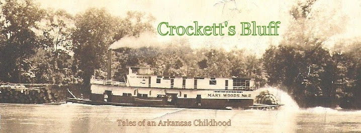
An official historical marker verifies today what was for more than a hundred years the center of the active community of Crockett's Bluff, Arkansas where I was born on an early September afternoon in 1935. Near this site stood during the years of my childhood a tall water tank of th e conventional sort that can still be seen on the skylines of small towns throughout America. Here it was designed with fire protection in mind for the Prange Farm warehouses that rested along the bluffs at the bend of the White River for which the site gets its name. For more than half a century, at least, it served as a focal point that could be seen actoss the prairie from as far as eight or more miles away. Today it almost totally abandoned. There remain, of course, "hunting cabins" here and there along the river, as well as a few permanently inhabited scattered houses, and there's occasional traffic from the outlying areas --from the "hill road" leading west toward Stuttgart and the almost straight asphalt stretch leading south toward St. Charles and DeWitt. But what was once an active river and farm community is today about as dead as it can be and still be said to have life at all. The marker provides the occasional visitor evidence there was once a lively village huddled around the long bend with the bluffs overlooking the river. Not more than a quarter of a mile west along Rt. 153 in the well-kempt cemetery near the Baptist Church lies more detailed evidence of that past life.
e conventional sort that can still be seen on the skylines of small towns throughout America. Here it was designed with fire protection in mind for the Prange Farm warehouses that rested along the bluffs at the bend of the White River for which the site gets its name. For more than half a century, at least, it served as a focal point that could be seen actoss the prairie from as far as eight or more miles away. Today it almost totally abandoned. There remain, of course, "hunting cabins" here and there along the river, as well as a few permanently inhabited scattered houses, and there's occasional traffic from the outlying areas --from the "hill road" leading west toward Stuttgart and the almost straight asphalt stretch leading south toward St. Charles and DeWitt. But what was once an active river and farm community is today about as dead as it can be and still be said to have life at all. The marker provides the occasional visitor evidence there was once a lively village huddled around the long bend with the bluffs overlooking the river. Not more than a quarter of a mile west along Rt. 153 in the well-kempt cemetery near the Baptist Church lies more detailed evidence of that past life.
Subscribe to:
Posts (Atom)